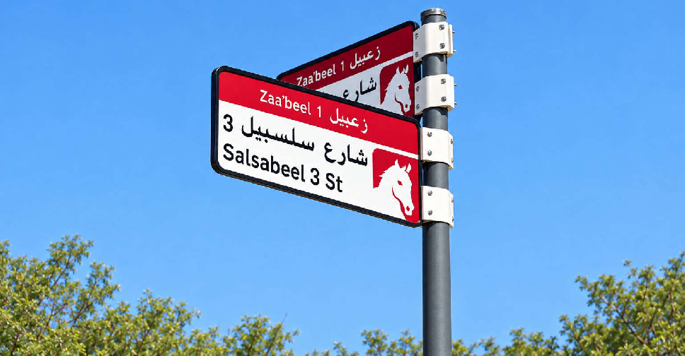
Dubai is rolling out a new visual identity and enhanced addressing system, introducing colour-coded area identities, updated street signs and house number plates.
The initiative, launched by the Supreme Committee for Urban Planning in coordination with Dubai's Roads and Transport Authority (RTA) and Dubai Municipality, is designed to make locations easier to identify, improve accessibility and strengthen the visual character of communities across the city.
The implementation plan covers 186 areas across 19 sectors and will be rolled out in phases from the fourth quarter of 2026 through to 2030.
The first phase will begin this year with the installation and replacement of more than 2,000 signs in Za'abeel 1, Za'abeel 2, Nad Al Sheba, Al Khawaneej 1 and Nazwa.
The new identity uses five colours linked to the geographic characteristics of different areas.
For example, blue represents areas close to the sea, while gold reflects areas with a desert landscape.
The project will also introduce QR codes and upgraded house number plates featuring Makani numbers, helping residents and visitors access location information more easily while supporting Dubai's continued urban development.
The Supreme Committee for Urban Planning, in coordination with RTA and Dubai Municipality, launches a new visual identity for the addressing system across the Emirate of Dubai. The project covers 186 areas and will be implemented in phases through 2030. The first phase includes… pic.twitter.com/1554bSMzpT
— Dubai Media Office (@DXBMediaOffice) October 7, 2026

 Abu Dhabi teams up with Elon Musk’s company to assess underground transport
 UAE President and Syria's Al-Sharaa discuss expanding cooperation
 UAE condemns Houthi attacks on Saudi airports
 Saudi King invites UAE President to GCC-EU summit